You can find your closest polling station by checking on the map. You can also use the postcode look-up on the Democracy Club website to get directions to your polling station.
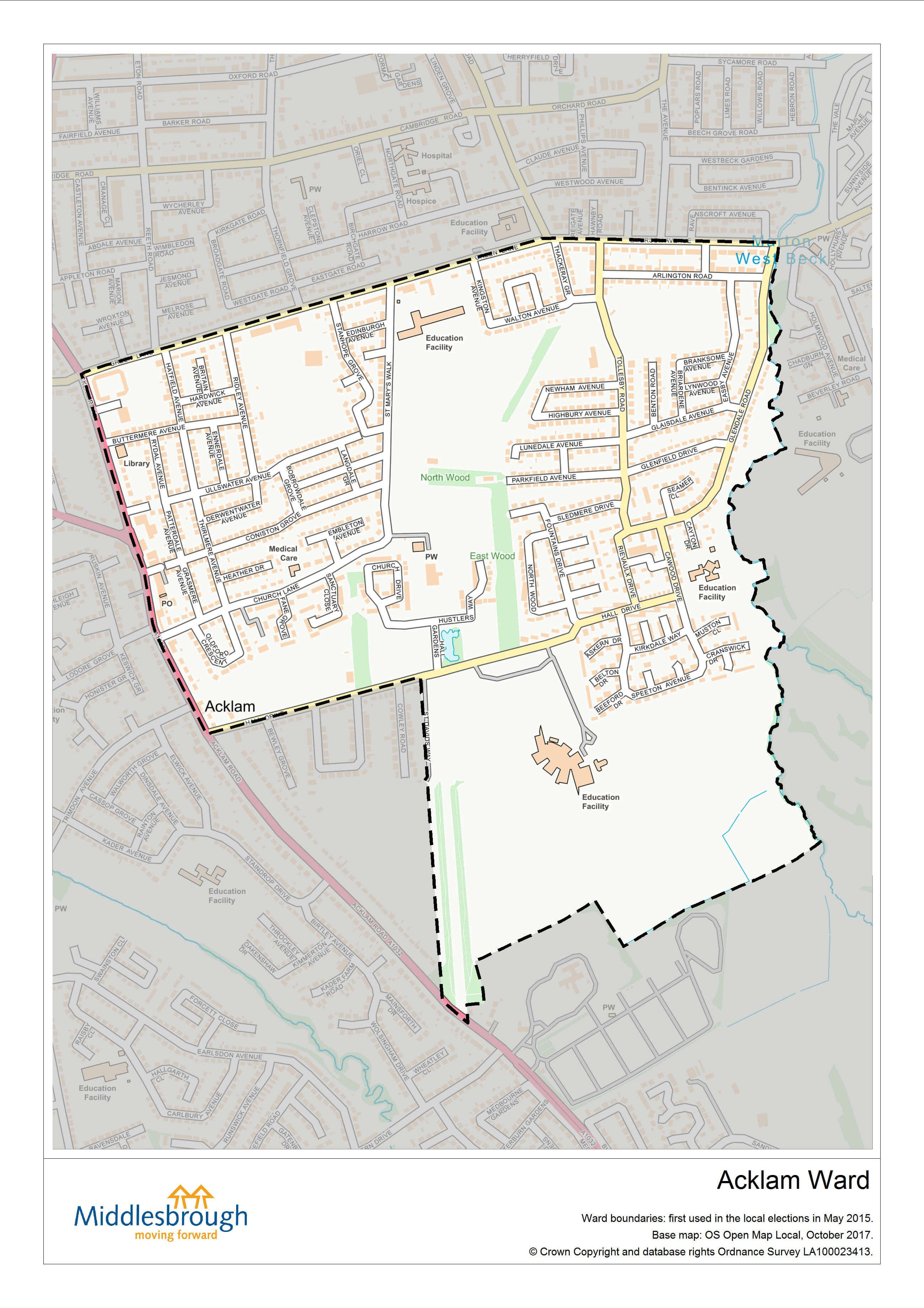
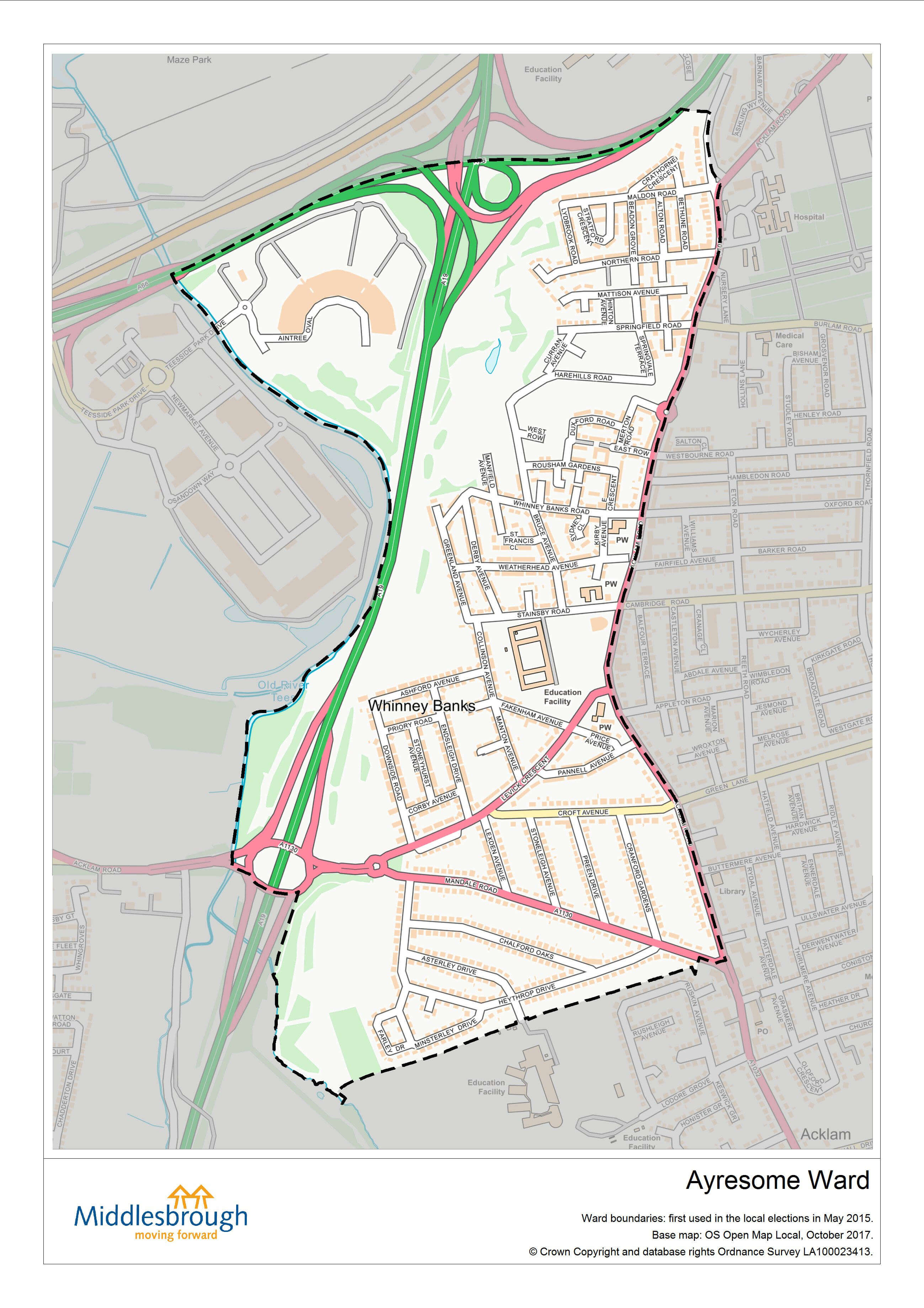
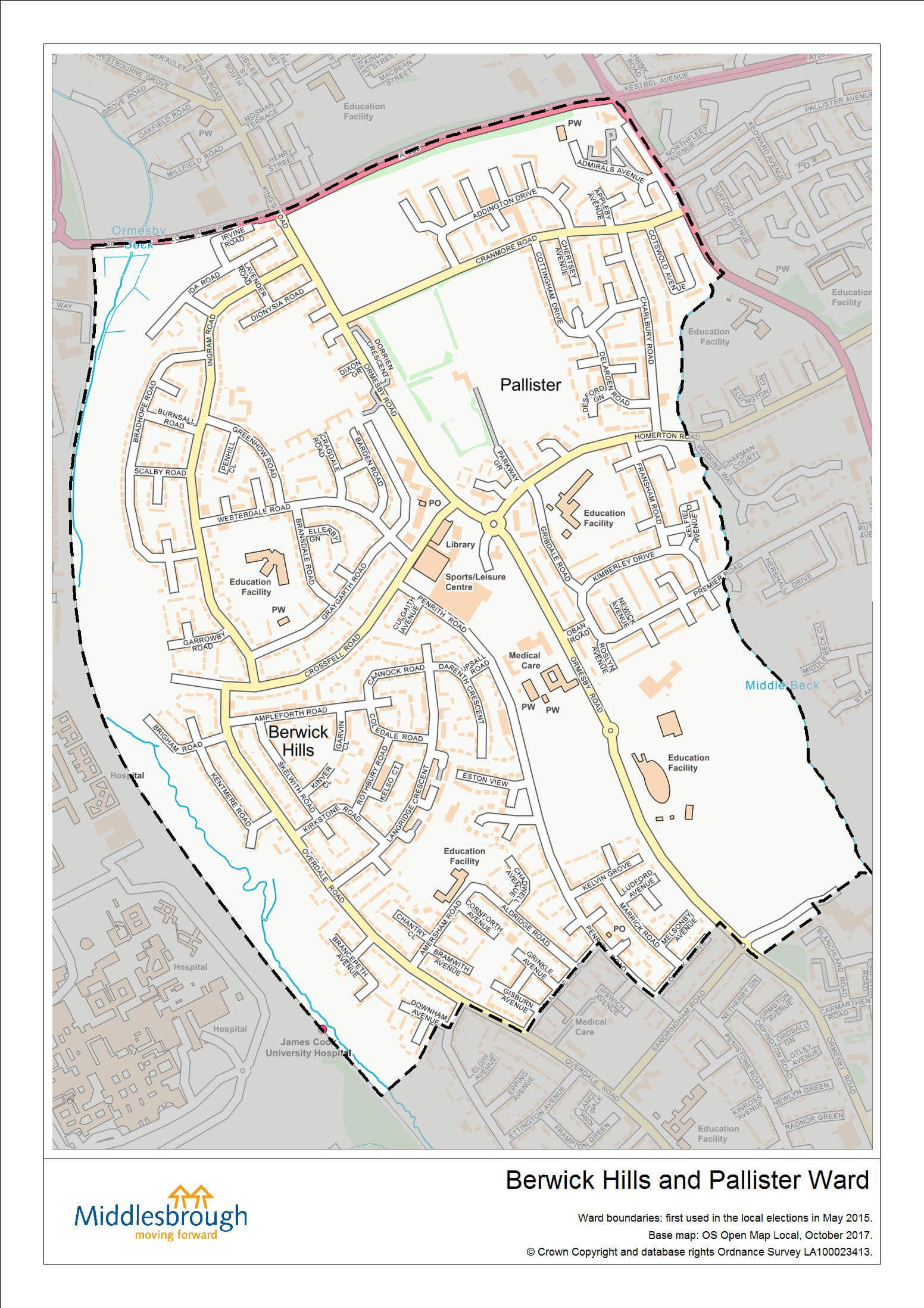
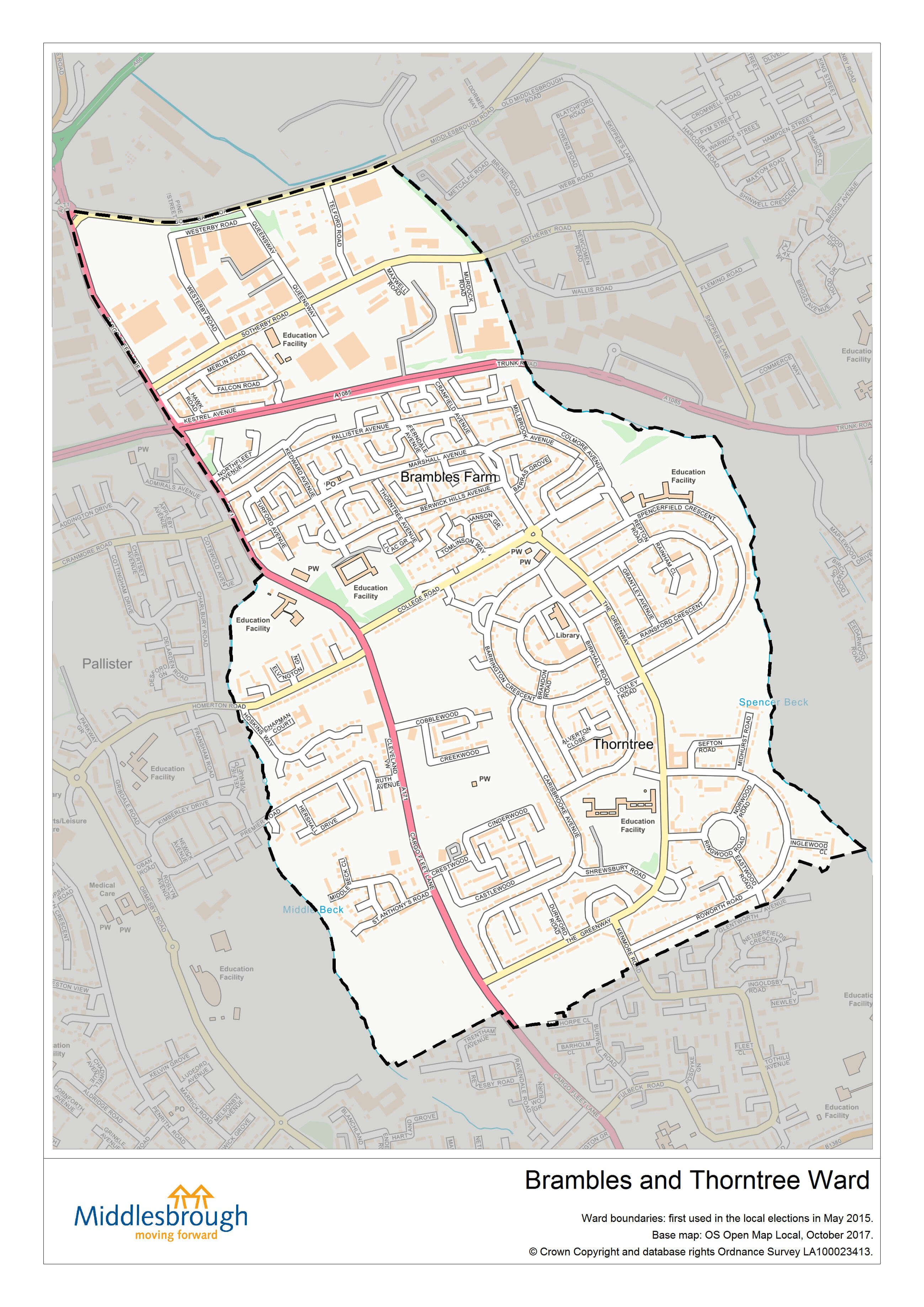
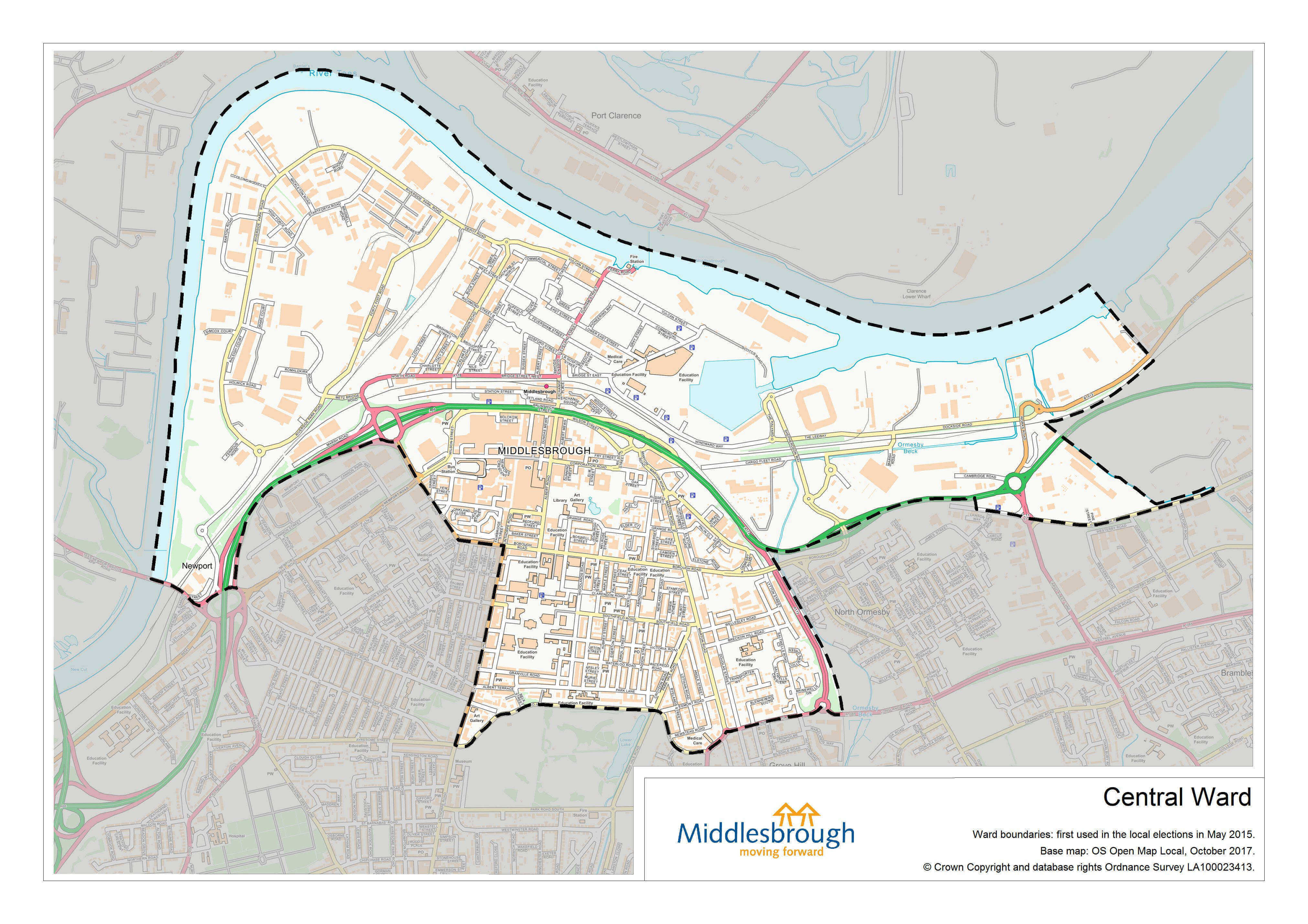
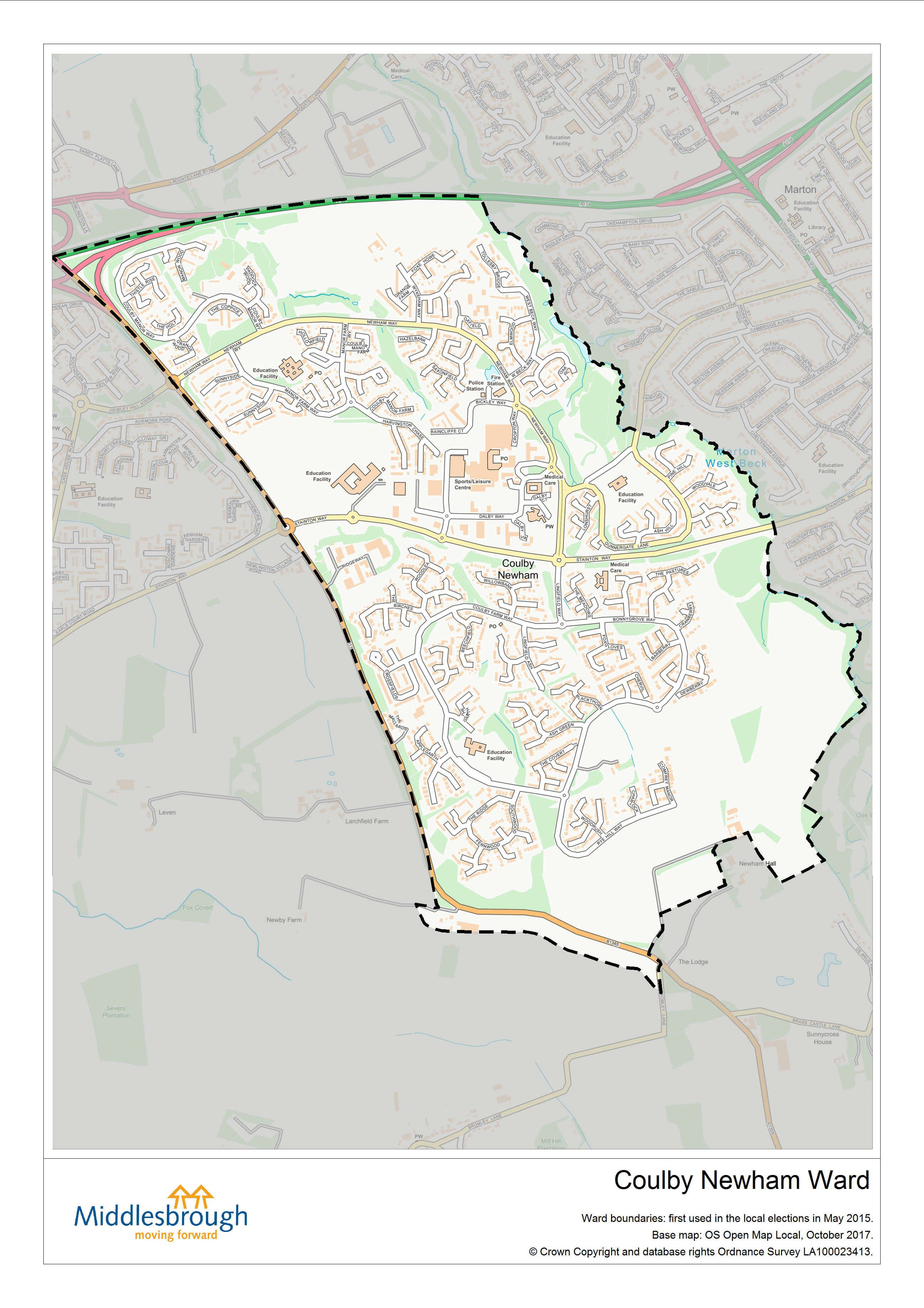
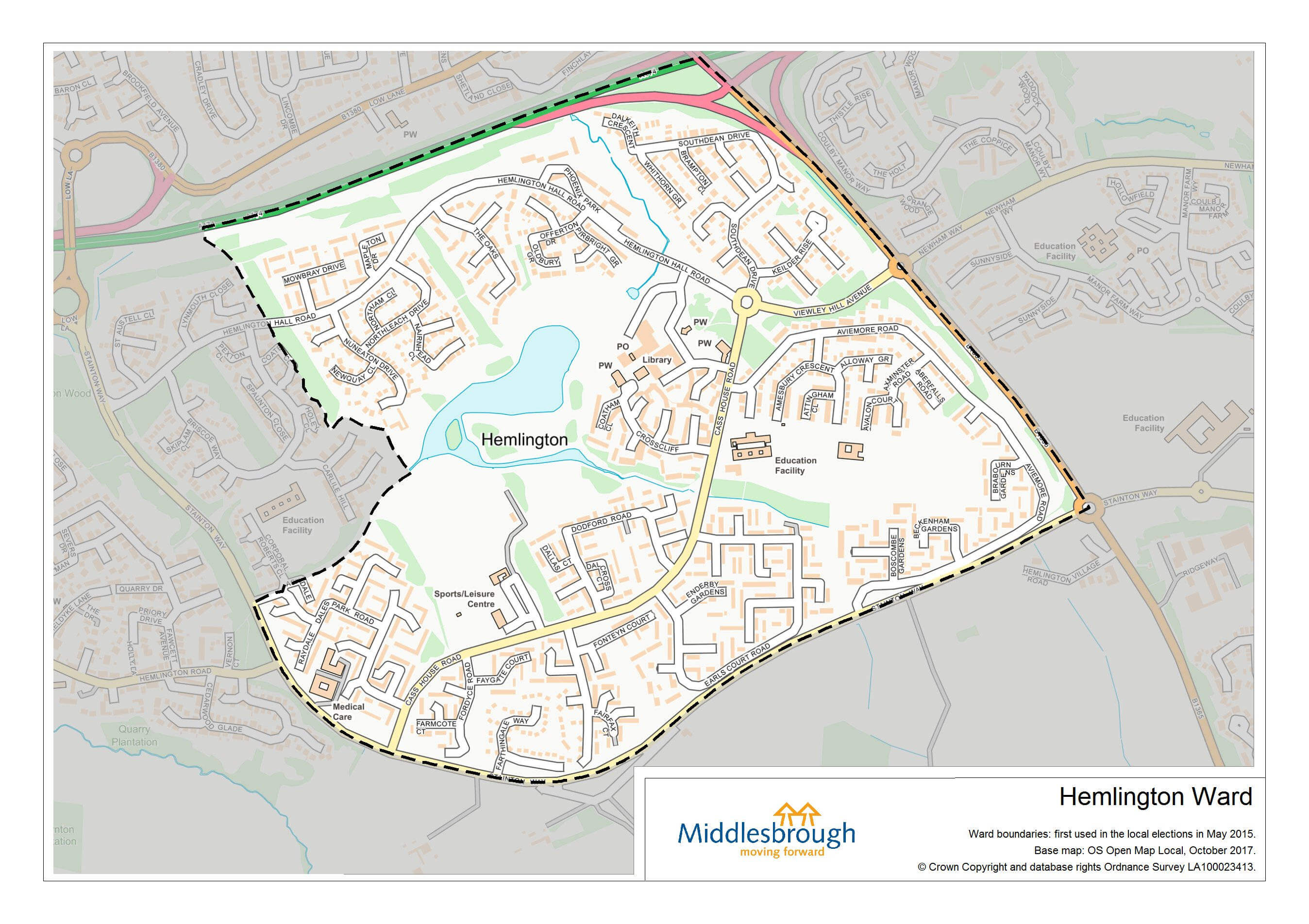
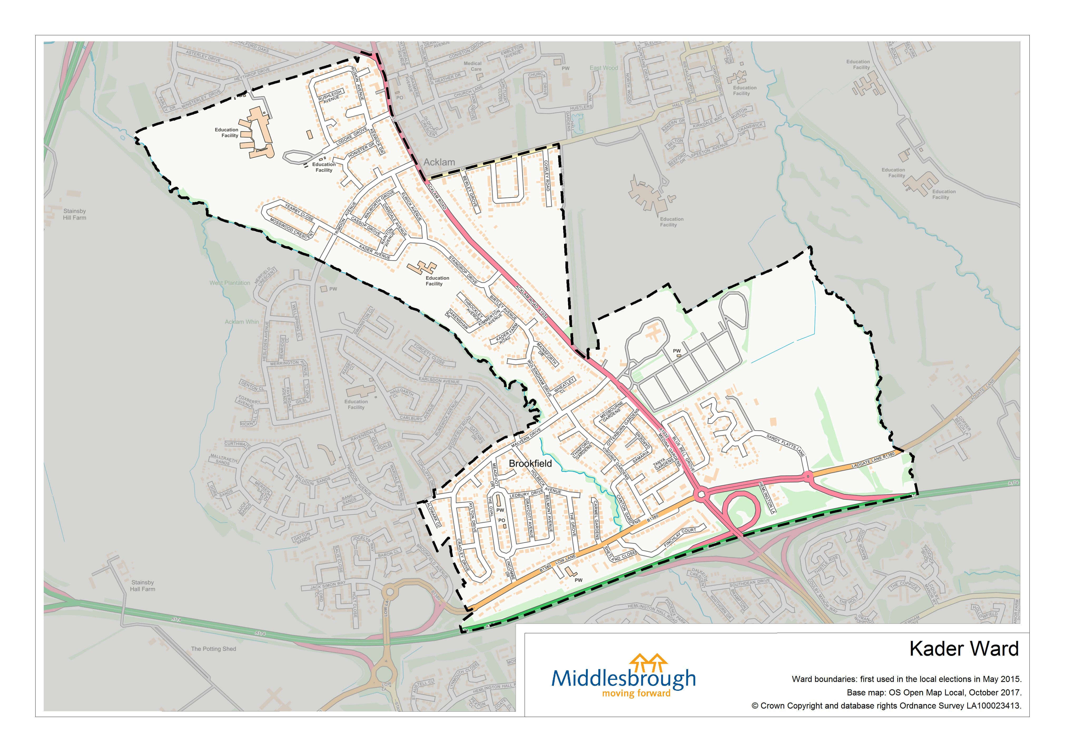
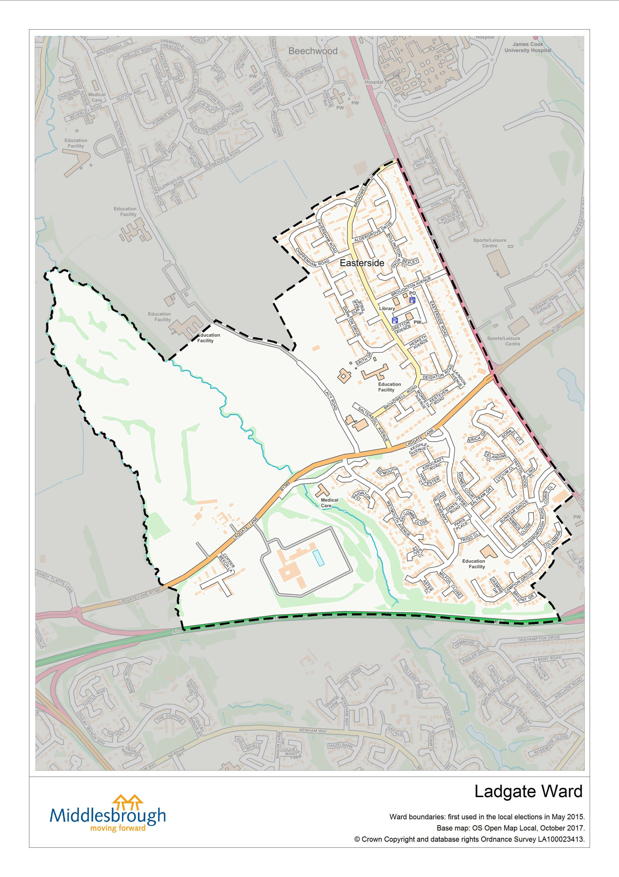
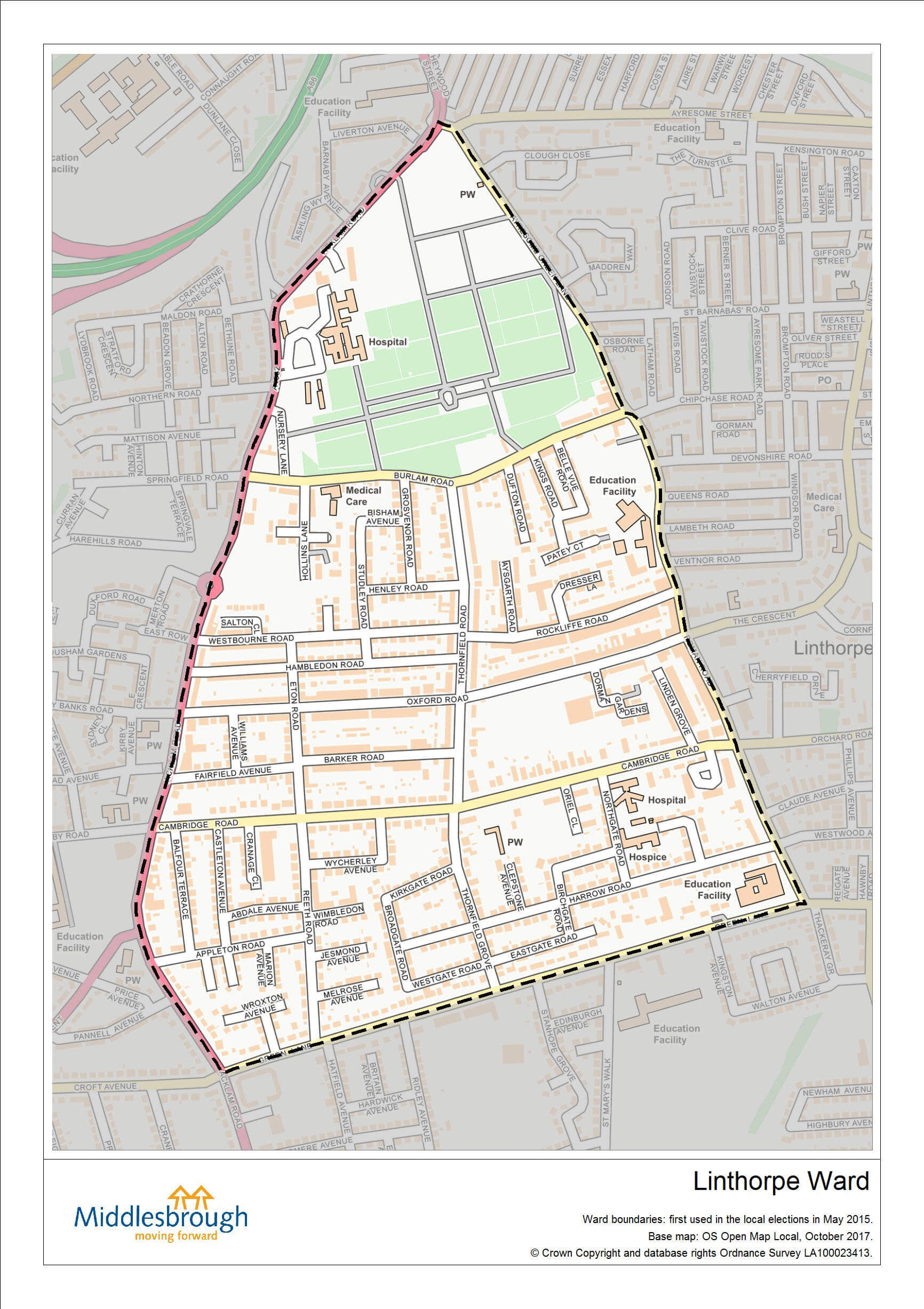
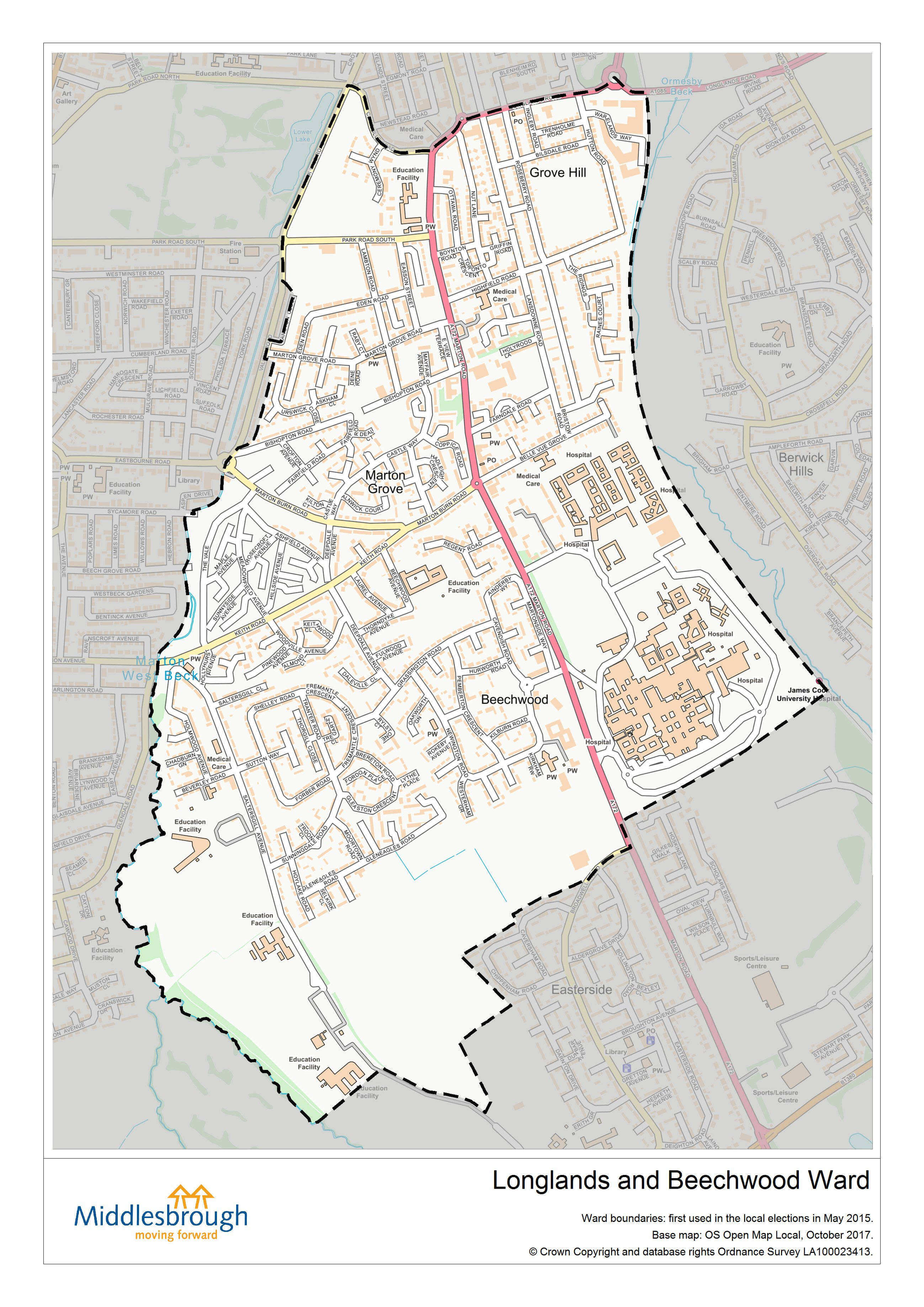
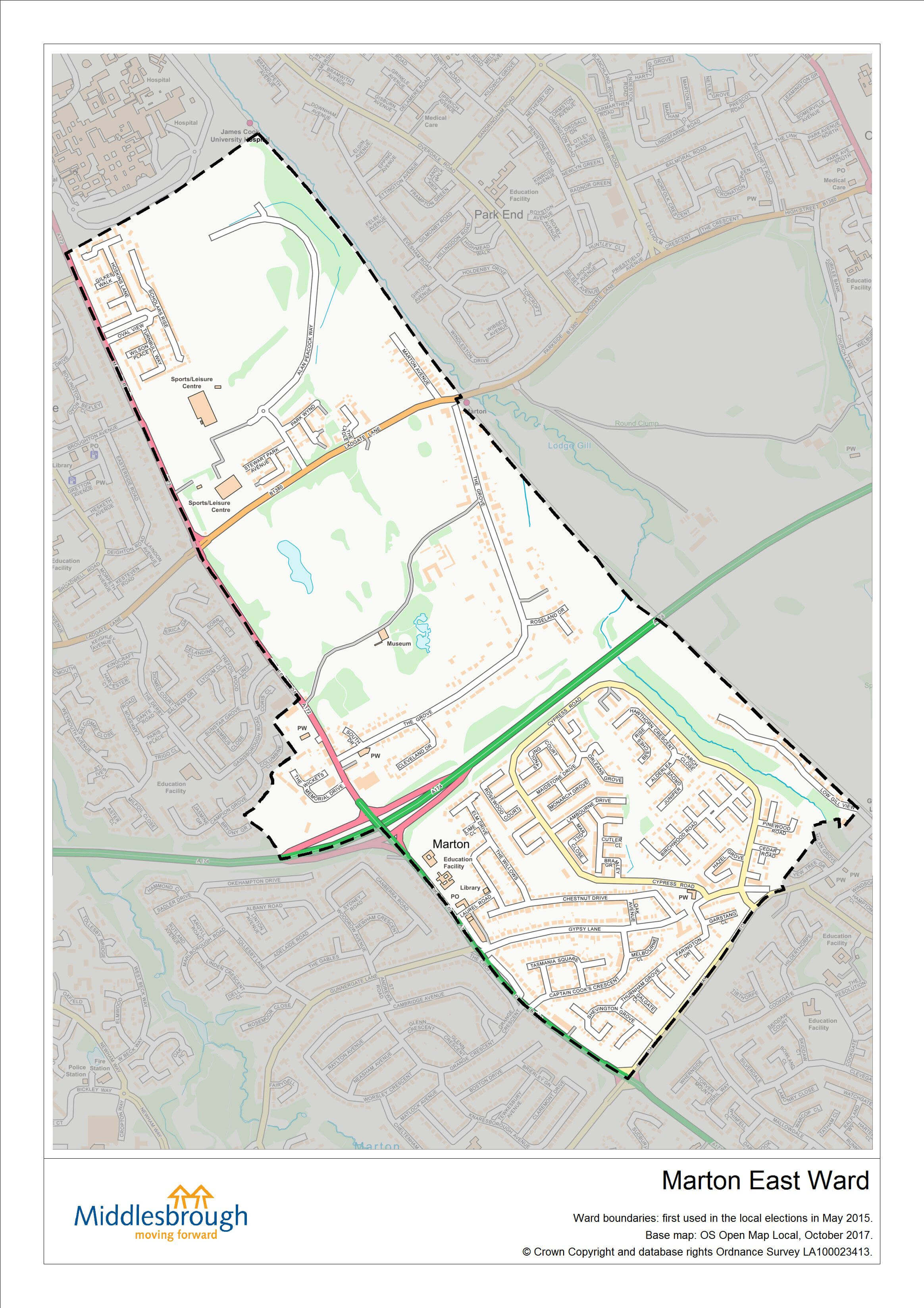
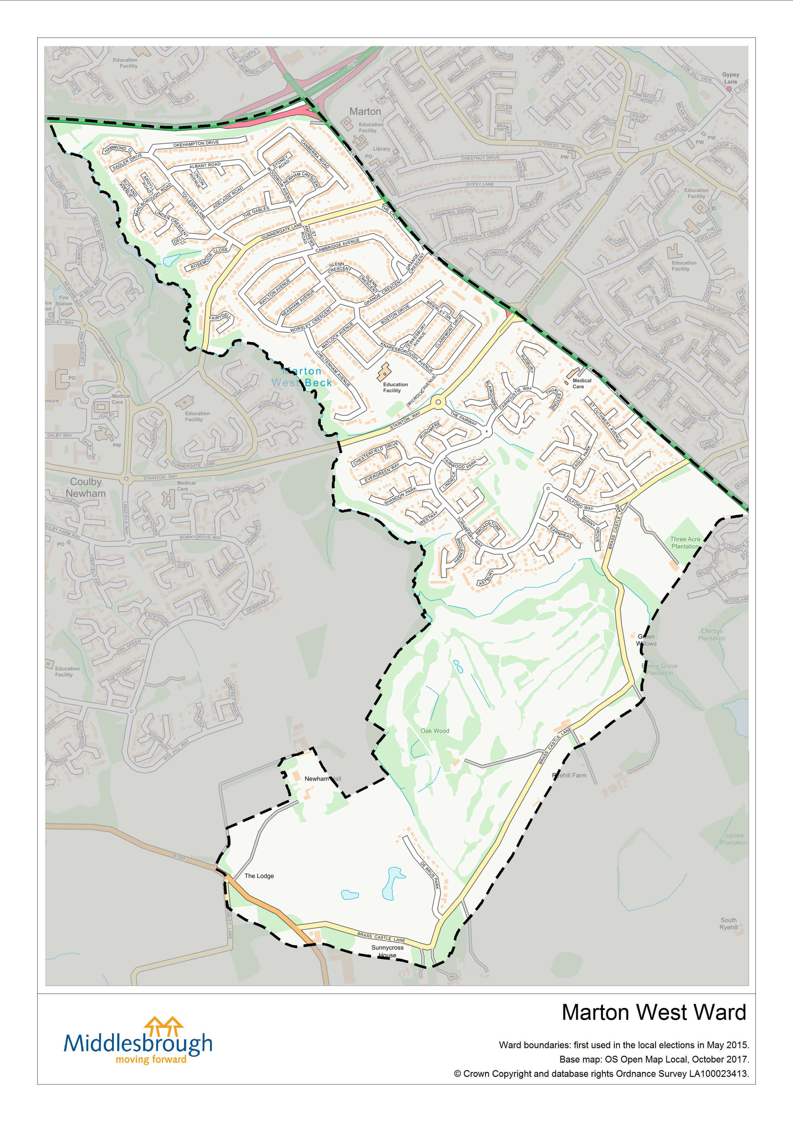
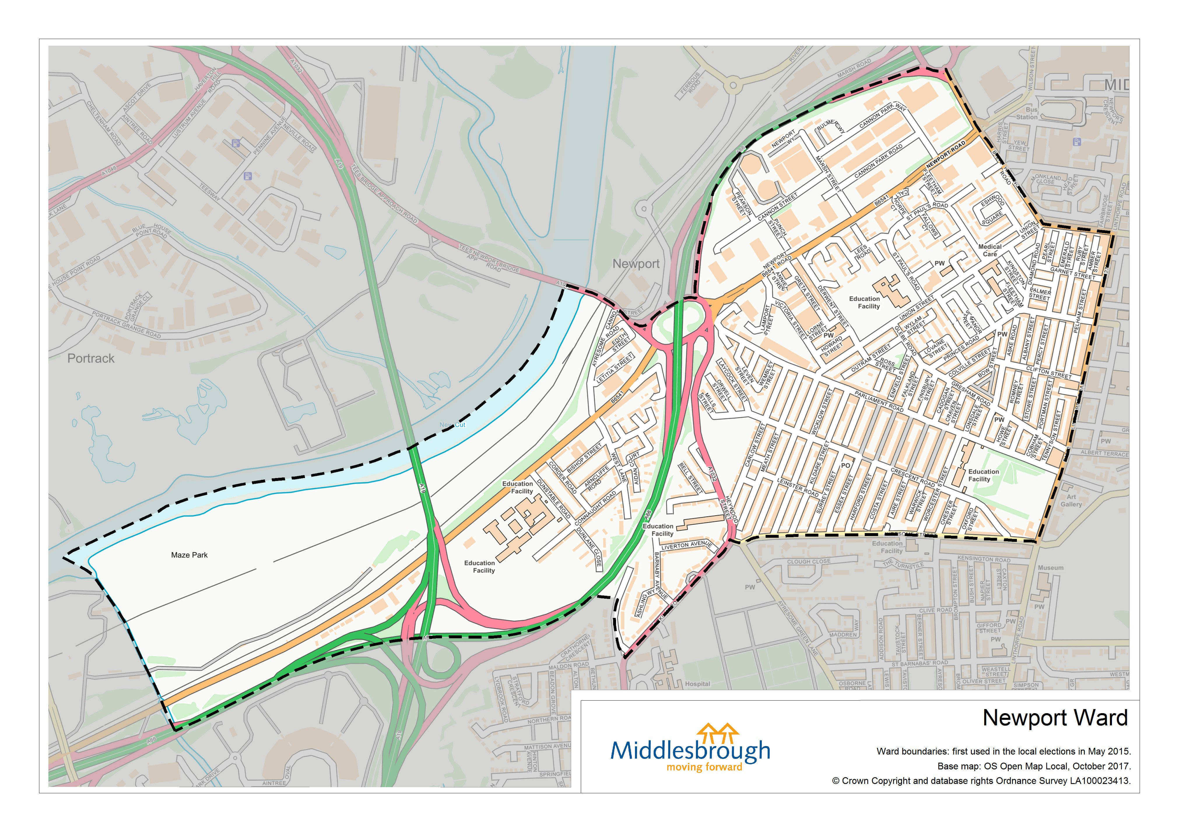
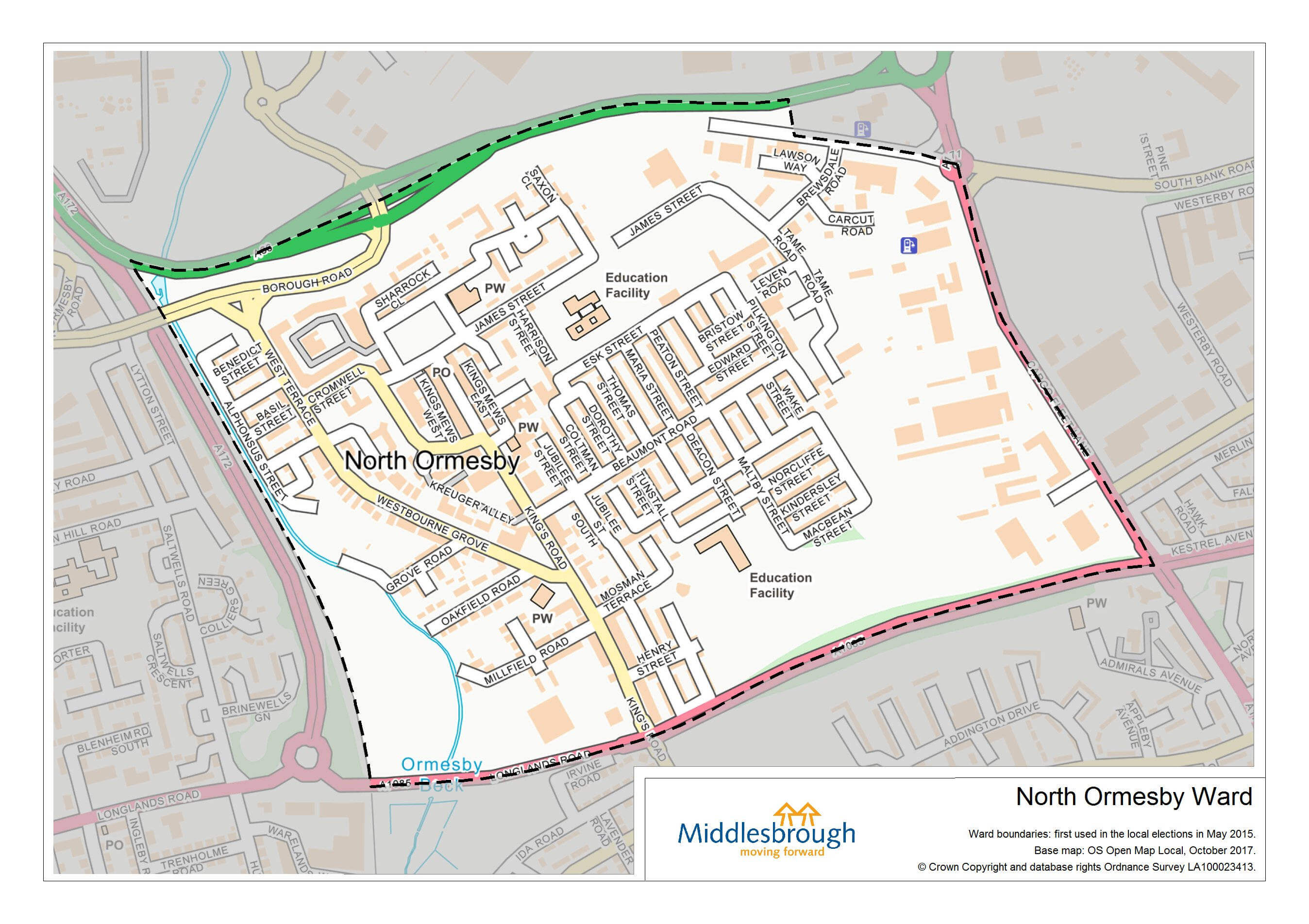
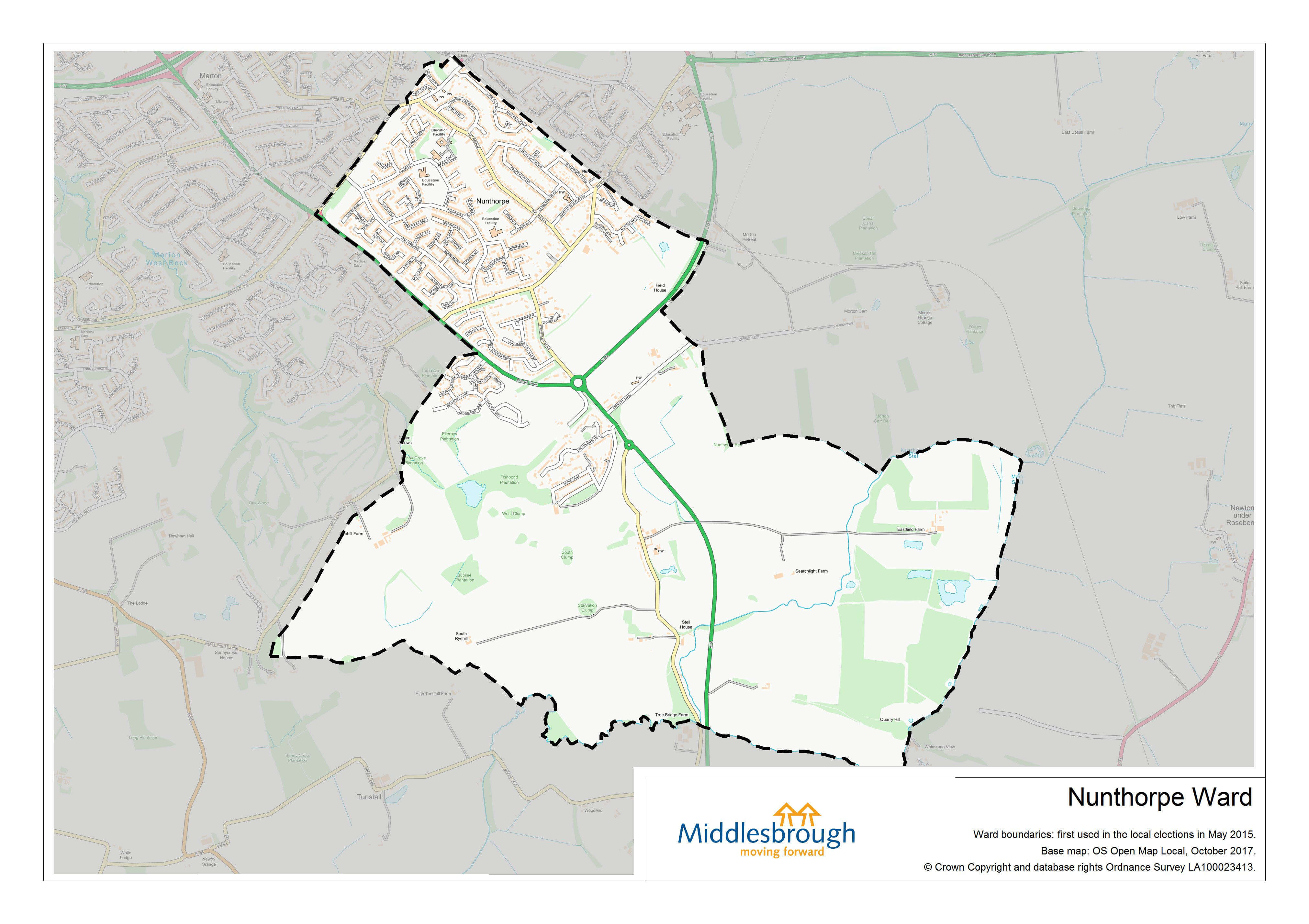
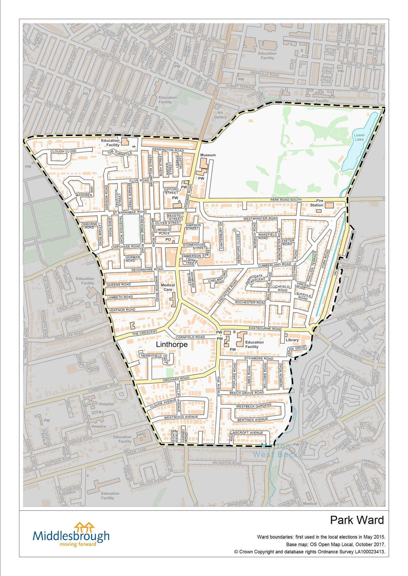
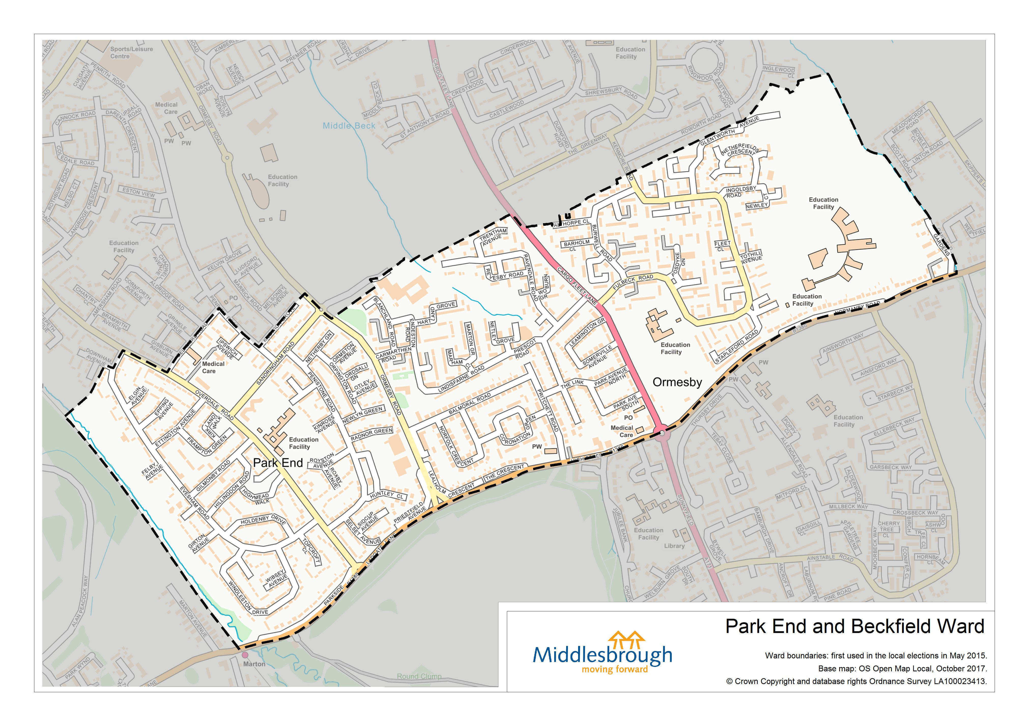
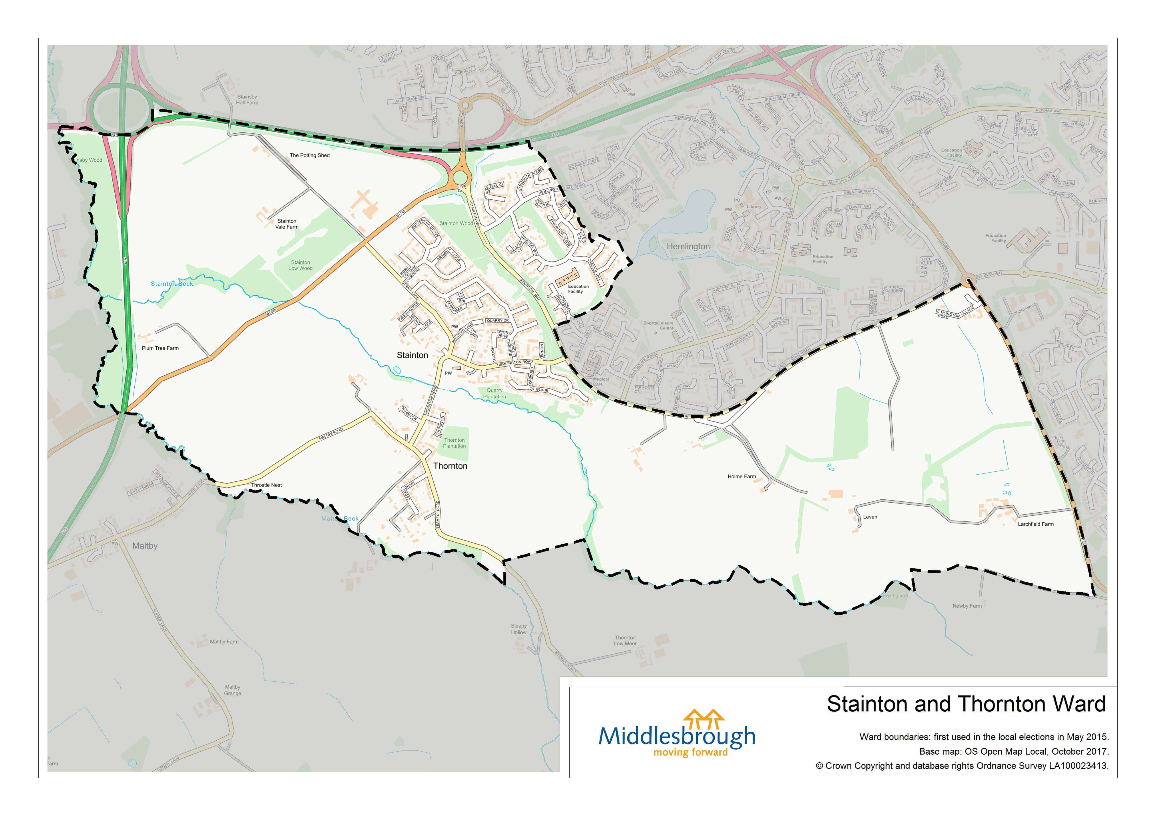
Polling station name | Address | Ward | Map of ward |
---|---|---|---|
Acklam Branch Library | Acklam Road, Middlesbrough, TS5 7AB |
Acklam | Acklam ward map |
Newham Bridge Primary School | Cayton Drive, Acklam, Middlesbrough, TS5 7NJ |
Acklam | |
Middlesbrough District Scout HQ | Tollesby Road, Middlesbrough, TS5 5PJ |
Acklam |
|
Mobile Station | Croft Avenue, Middlesbrough, TS5 8AU |
Ayresome | Ayresome ward map |
Mobile Station | Northern Road, Middlesbrough, TS5 4NS |
Ayresome | |
Whinney Banks School | Fakenham Avenue, Middlesbrough, TS5 4QQ |
Ayresome | |
Berwick Hills Primary School | Westerdale Road, Middlesbrough, TS3 7QH |
Berwick Hills and Pallister | Berwick Hills and Pallister ward map |
Pallister Park Primary School | Gribdale Road, Middlesbrough, TS3 8PW |
Berwick Hills and Pallister | |
Bellamy Court Residents Lounge | Pallister Park, Middlesbrough, TS3 8RL |
Berwick Hills and Pallister | |
St. Pius X R.C. Primary School | Amersham Road, Park End, Middlesbrough, TS3 7HD |
Berwick Hills and Pallister | |
Brambles Farm Community Centre | Marshall Avenue, Brambles Farm, Middlesbrough, TS3 9AY |
Brambles and Thorntree | Brambles and Thorntree ward map |
Corpus Christi RC Academy | Cargo Fleet Lane, Middlesbrough, TS3 8NL |
Brambles and Thorntree | |
Thorntree Community Hub | Birkhall Road, Middlesbrough, TS3 9JW |
Brambles and Thorntree | |
Thorntree Primary School | The Greenway, Thorntree, Middlesbrough, TS3 9NH |
Brambles and Thorntree | |
Abingdon Primary School | Abingdon Road, Middlesbrough, TS1 3JR |
Central | Central ward map |
Breckon Hill Community Centre | Breckon Hill Road, Middlesbrough, TS4 2DS |
Central | |
International Centre | 7 Abingdon Road, Middlesbrough, TS1 2DP |
Central | |
St Aidans Meeting Room | Head Street, Middlesbrough, TS1 5TR |
Central | |
Langdon Square Community Centre | 1 Langdon Square, Coulby Newham, Middlesbrough, TS8 0TF |
Coulby Newham | Coulby Newham ward map |
Lingfield Ash Meeting Hall | 95 Lingfield Ash, Coulby Newham, Middlesbrough, TS8 8SU |
Coulby Newham | |
Rose Wood Academy | The Garth, Coulby Farm Way, Middlesbrough, TS8 0UG |
Coulby Newham | |
Sunnyside Academy | Manor Farm Way, Coulby Newham, Middlesbrough, TS8 0RJ |
Coulby Newham | |
Hemlington Library | Crosscliffe, Hemlington, Middlesbrough, TS8 9JJ |
Hemlington | Hemlington ward map |
Hemlington Recreation Centre | Cass House Road, Hemlington, Middlesbrough, TS8 9QW |
Hemlington | |
Community Centre | Otterhill Court, Hemlington, Middlesbrough, TS8 9PY |
Hemlington | |
Viewley Hill Academy | Andover Way, Middlesbrough, TS8 9HL |
Hemlington | |
City Learning Centre | Acklam Grange School, Lodore Grove, Middlesbrough, TS5 8PB |
Kader | Kader ward map |
Kader Academy | Staindrop Drive, Middlesbrough, TS5 8NU |
Kader | |
Mobile station | Junction of Medina Gardens / Acklam Road, Middlesbrough, TS5 8BN |
Kader | |
St Margaret's Church Hall | The Oval, Brookfield, Middlesbrough, TS5 8EU |
Kader | |
Easterside Community Hub | Broughton Avenue, Easterside, Middlesbrough, TS4 3PZ |
Ladgate | Ladgate ward map |
Marton Manor Primary School | The Derby, Marton-in-Cleveland, Middlesbrough, TS7 8RH |
Ladgate | |
Baptist Church Hall | Cambridge Road, Linthorpe, Middlesbrough, TS5 5NN |
Linthorpe | Linthorpe ward map |
Friends Meeting House | 131 Cambridge Road, Middlesbrough, TS5 5HL |
Linthorpe | |
Linthorpe Community School | Roman Road, Linthorpe, Middlesbrough, TS5 6EA |
Linthorpe | |
Grove Hill Community Hub | Bishopton Road, Middlesbrough, TS4 2RP |
Longlands and Beechwood | Longlands and Beechwood ward map |
Mobile Station | Kildale Road, Middlesbrough, TS4 2LL |
Longlands and Beechwood | |
Swerve Table Tennis Centre | Kirkham Row, Middlesbrough, TS4 3EE |
Longlands and Beechwood | |
The Sutton Centre | 24 Collin Avenue, Middlesbrough, TS4 3HF |
Longlands and Beechwood | |
Captain Cook Primary School | Stokesley Road, Marton, Middlesbrough, TS7 8DU |
Marton East | Marton East ward map |
Marton Community Centre | Cypress Road, Middlesbrough, TS7 8PZ |
Marton East | |
Middlesbrough Sports Village | Alan Peacock Way, Middlesbrough, TS4 3AE |
Marton East | |
Lingfield Primary School | Buxton Avenue, Marton, Middlesbrough, TS7 8LP |
Marton West | Marton West ward map |
Normanby Court | Linden Crescent, Marton, Middlesbrough, TS7 8LE |
Marton West | |
Mobile Station | Fulford Way, Marton, Middlesbrough |
Marton West | |
Ayresome Academy | Worcester Street, Middlesbrough, TS1 4NT |
Newport | Newport ward map |
Macmillan Academy | Stockton Road, Middlesbrough, TS5 4AG |
Newport | |
Newport Settlement | St Paul's Road, Middlesbrough, TS1 5NQ |
Newport | |
St. Aidans Centre | Clifton Street, Middlesbrough, TS1 4BZ |
Newport | |
ACTES Resource Centre | Meath Street, Middlesbrough, TS1 4QZ |
Newport | |
North Ormesby Community Hub | Derwent Street, North Ormesby, Middlesbrough, TS3 6JB |
North Ormesby | North Ormesby ward map |
St Alphonsus RC Primary | Cadogan Street, Middlesbrough, TS3 6PX |
North Ormesby | |
The Brunton Suite | The Avenue Primary School, The Avenue, Nunthorpe, Middlesbrough, TS7 0AG |
Nunthorpe |
|
Chandlers Ridge Primary School | Chandlers Ridge, Nunthorpe, Middlesbrough, TS7 0JL |
Nunthorpe | |
The Avenue Primary School | The Avenue, Nunthorpe, Middlesbrough, TS7 0AG |
Nunthorpe | |
Linthorpe Community Centre | 468 Linthorpe Road, Middlesbrough, TS5 6HX |
Park | Park ward map |
Sacred Heart Primary School (Nursery) | Ayresome Street, Middlesbrough, TS1 4NP |
Park | |
St Barnabas Church Hall | 1 St Barnabas Road, Middlesbrough, TS5 6JR |
Park | |
St Edwards RC Primary School | Eastbourne Road, Middlesbrough, TS5 6QS |
Park | |
Glastonbury House | Lindisfarne Road (access from Ormesby Road), Middlesbrough, TS3 0LF |
Park End and Beckfield | Park End and Beckfields ward map |
Netherfields Community Centre | Fulbeck Road, Middlesbrough, TS3 0RN |
Park End and Beckfield | |
Park End Primary School | Overdale Road, Park End, Middlesbrough, TS3 0AA |
Park End and Beckfield | |
Memorial Hall | Meldyke Lane, Stainton, Middlesbrough, TS8 9AV |
Stainton and Thornton | Stainton and Thornton ward map |
Hemlington Hall Academy | Briscoe Way, Hemlington Hall Road, Middlesbrough, TS8 9SJ |
Stainton and Thornton | |
Mobile station | Junction of Jocelyn Way / Jack Simon Way, Middlesbrough, TS5 8EJ |
Trimdon | Trimdon ward map |
Sure Start Building | Acklam Whin Primary School, Carlbury Avenue, Acklam, Middlesbrough, TS5 8SQ |
Trimdon | |
The Nursery | St Clares RC Primary School, Trimdon Avenue, Middlesbrough, TS5 8RZ |
Trimdon |